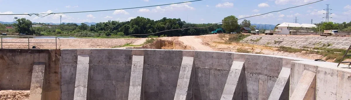
Most people don't realize how much variation there is in the subsurface across the Salt Lake Valley until they start digging deeper than a standard basement. In West Valley City, what looks like uniform alluvial fan deposits at the surface can shift dramatically within a few hundred feet—layers of silty clay giving way to pockets of poorly graded sand with high groundwater influence from the Jordan River system. We see this pattern repeatedly on projects along the Bangerter Highway corridor and near the Decker Lake basin, where the water table sits barely 8 to 12 feet below grade for much of the year. When excavation faces extend below that line, the behavior of the cut changes entirely, and without continuous geotechnical monitoring the risk of basal instability or sudden inflow jumps significantly. Combining deep excavation design with live instrumentation lets us verify that the support system is working within the deflection limits assumed during analysis, and that the surrounding infrastructure—often including UDOT right-of-way and aging residential utilities—isn't silently accumulating damage.
Real-time inclination data from a shored cut on the West Valley side of the Decker Lake basin caught a 0.2-inch drift in less than four hours—enough to trigger anchor re-tensioning before any crack appeared in the adjacent pavement.
Local geotechnical context
A project we consulted on near the Jordan River Parkway involved a 22-foot-deep excavation for a mixed-use building, supported by a temporary soil nail wall designed for drained conditions. The geotechnical report had noted a thin lens of silty sand at about 16 feet, but the contractor assumed it was discontinuous. Three days after reaching that depth, a localized seepage face developed on the east corner of the cut, and within 48 hours the nail heads in that zone showed 60% more tension than the lock-off load. Because monitoring was already in place—inclinometer readings, load cells on selected nails, and a piezometer installed just outside the shoring line—the field team identified the problem before any face loss occurred. The design engineer used that data to add horizontal drains and increase the nail density in the affected panel, and the excavation proceeded without further incident. That sequence illustrates what we've learned working in West Valley City's lacustrine soils: the margin between a controlled cut and a costly repair is measured in hours, and the instrumentation is what buys you those hours.
Common questions
How often should excavation monitoring data be collected during active earthwork in West Valley City?
Frequency depends on the excavation stage and the deformation rate trend. During active digging below the first anchor or strut level, we typically collect inclinometer and piezometer data daily, and survey monitoring points at least three times per week. If readings stabilize and the groundwater response is predictable, the schedule can drop to twice weekly. When we see acceleration—say, a continuous 0.01-inch-per-day drift—we move back to daily readings and notify the design engineer immediately. The IBC and ASCE 7 don't prescribe a rigid timetable; the right frequency follows the risk profile of the adjacent structures and the behavior the instruments are actually showing.
What is the typical cost for geotechnical excavation monitoring on a commercial project in West Valley City?
For a commercial excavation in the 15- to 25-foot depth range, with a standard array of inclinometers, piezometers, and settlement points, the monitoring package generally falls between US$750 and US$2,270 per month depending on instrument count, reporting frequency, and whether we are also managing the dewatering data. Projects that require additional load cells, real-time telemetry, or crackmeter arrays on multiple adjacent buildings will fall toward the upper end. Every scope is quoted based on the specific instrument layout and the monitoring duration defined in the earthwork schedule.
Which parameters trigger an automatic notification during monitoring?
We pre-set alert thresholds during the instrumentation plan review, tied to the project's deflection criteria and groundwater drawdown limits. Typical triggers include lateral displacement exceeding 0.25 inches or 1/500 of the wall height, pore pressure increases of more than 20% above the design baseline, settlement rates exceeding 0.04 inches per day on adjacent structures, and anchor load variations beyond 15% of the lock-off value. Any single exceedance generates an email and SMS to the project engineer and superintendent, with a summary plot attached, so decisions happen the same shift rather than after the next weekly report.
Does West Valley City require excavation monitoring for projects near UDOT right-of-way?
Yes, UDOT and West Valley City engineering departments routinely require monitoring plans when shoring is within the zone of influence of state or city right-of-way, particularly along corridors like Bangerter Highway or 5600 West. The requirements typically include pre-construction condition surveys, settlement points on the pavement and utilities, and inclinometers if the excavation depth exceeds 12 feet. The specific instrumentation package must be submitted as part of the encroachment permit application, and the monitoring data is usually shared with the city's geotechnical reviewer at agreed intervals.